
If you are planning to travel across the Sierra Nevada, a donner pass cam can be a useful way to see what is happening on the road before you leave. Donner Summit is an important section of Interstate 80 between the Sacramento region and Truckee, and conditions can change quickly because of elevation, winter storms, wind, snow, and heavy traffic. Live cameras give travelers a visual look at pavement conditions, visibility, snowfall, traffic flow, and surrounding weather.
Unlike a written forecast, a camera can show you what the roadway actually looks like at a particular location. This is especially valuable during winter when roads may become snowy or icy within a short period. Cameras are also useful during summer travel, holiday weekends, construction periods, and busy ski-season days.
Why Live Cameras Are Useful at Donner Summit
Donner Pass sits at a high elevation in the Sierra Nevada, making weather an important consideration for anyone traveling through the area. A forecast may say snow is expected, but a camera can help you understand whether snow is currently accumulating, whether vehicles are moving normally, and how much visibility drivers have.
Live views can help with several travel decisions.
Checking Road Conditions
Before starting a trip, look at several camera locations rather than relying on a single view. Road conditions can differ considerably between lower elevations and the summit.
A camera may reveal:
- Snow-covered pavement
- Wet or slushy roads
- Clear pavement
- Reduced visibility
- Heavy traffic
- Slow-moving vehicles
- Road maintenance activity
- Fresh snowfall
- Dry summer conditions
Checking multiple points along the route provides a better picture of the entire journey.
Understanding Weather Changes
Mountain weather can change faster than conditions in nearby valleys. A sunny afternoon in Sacramento does not necessarily mean the summit will have the same conditions.
Live images can help travelers see whether clouds, snow, fog, or strong weather are affecting the pass. This is particularly helpful when temperatures are close to freezing.
Where to Find Live Views
Several sources provide views around Donner Summit and the surrounding Sierra Nevada. Caltrans-related camera feeds are particularly useful for drivers because they focus on highway locations.
Current camera listings include views such as Donner Summit, Castle Peak, Soda Springs, Kingvale, and other sections of I-80.
Ski-area cameras provide another perspective. Sugar Bowl, located near Donner Summit, offers several views of the surrounding mountain environment and ski area. Its cameras include locations such as the main lodge, Mt. Disney, Royal Gorge, and other mountain viewpoints.
Highway Cameras vs. Mountain Cameras
The type of camera you choose depends on what you need to know.
| Camera Type | Best For | What You Can See |
|---|---|---|
| Highway camera | Driving decisions | Traffic, pavement, visibility |
| Summit camera | Mountain conditions | Snow, weather, road environment |
| Ski-area camera | Snow and recreation | Slopes, snowfall, mountain views |
| Rail camera | Train activity | Tracks and passing trains |
| Weather-oriented camera | General conditions | Sky, visibility, surrounding landscape |
For a road trip, highway cameras should generally be your first choice. Mountain and ski cameras can then provide additional context.
How to Check Conditions Before a Winter Trip
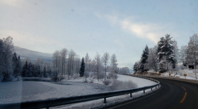
Winter is when live cameras become especially valuable. Donner Summit can experience significant snow and difficult driving conditions during major storms.
Before leaving, use a simple checking routine.
1. Check the Forecast
Start with the weather forecast for the pass and surrounding communities. Look for predicted snowfall, temperature, wind, and storm timing.
2. Check Several Cameras
Do not depend on one camera. Look at locations approaching the summit and locations beyond it.
For example, a driver heading east can compare conditions near Kingvale, Soda Springs, Castle Peak, and Donner Summit.
3. Check Official Road Information
A camera provides visual information, but it does not replace official road restrictions or closure information. Traffic incidents, chain controls, and closures should be confirmed through official transportation information.
4. Recheck Before Departure
Mountain conditions can change quickly. If a storm is developing, check again shortly before leaving rather than relying on an image viewed several hours earlier.
5. Prepare Your Vehicle
During winter travel, make sure your vehicle is properly equipped for the conditions. Carry required traction equipment when applicable and understand how chain controls work before reaching the mountain.
What to Look for in a Camera Image
A live image contains more information than simply whether the road looks snowy.
Pavement Condition
Look closely at the travel lanes. A road that appears gray or dark may be wet, while lighter areas can indicate snow or slush.
Tire Tracks
Visible tire tracks can help indicate whether snow is accumulating on the roadway. However, tire tracks should not be interpreted as proof that conditions are safe.
Visibility
Fog, blowing snow, and heavy snowfall can significantly reduce visibility. Even if the pavement looks manageable, poor visibility can make driving hazardous.
Traffic Speed
Look at how quickly vehicles are moving. A long line of slow-moving traffic may indicate congestion, weather-related caution, an incident, or restrictions farther along the route.
Snowbanks
During winter, snowbanks along the highway can become substantial. Their presence can provide useful visual context about recent snowfall and winter maintenance.
Best Times to Check the Cameras
There is no single perfect time to look at a live camera. The best timing depends on your trip.
Before Leaving Home
This is the most important check. Review the route before you start driving.
During Active Storms
If snow is falling, check frequently. Conditions can change considerably within an hour.
Before Climbing the Sierra
If you are approaching from lower elevations, check the higher portions of the route before beginning the climb.
During Holiday Travel
Traffic can become heavy around major holidays and ski weekends. Camera views can help you see whether congestion is developing.
Before Returning Home
If you are staying around Truckee, Lake Tahoe, or the surrounding mountains, check the cameras again before beginning your return trip.
Donner Summit During Different Seasons
Conditions at the pass are not the same throughout the year.
| Season | Typical Camera Information to Watch |
|---|---|
| Winter | Snow, ice, chain controls, visibility, traffic |
| Spring | Melting snow, wet pavement, changing weather |
| Summer | Traffic, construction, clear-road conditions |
| Fall | Rain, early snow, changing temperatures |
Winter
Winter is the most demanding season for mountain travel. Snowstorms can create rapidly changing road conditions, while freezing temperatures can lead to icy surfaces.
Spring
Spring can bring a mixture of clear weather, rain, snow, and melting conditions. Cameras are helpful because conditions may vary substantially from day to day.
Summer
Summer usually provides easier driving conditions, but traffic can become heavy during vacations and weekends. Cameras can help travelers estimate congestion.
Fall
Fall is a transition period. Early winter storms can arrive unexpectedly, so checking conditions becomes increasingly important as temperatures drop.
Using Cameras for Road Trips
A camera is not only useful for emergency weather situations. It can also improve normal road-trip planning.
Suppose you are traveling from the Sacramento area toward Truckee. Instead of checking only the weather forecast, you can examine several camera points along I-80.
You might compare:
- Conditions approaching the mountain.
- Traffic farther up the highway.
- Conditions around Soda Springs.
- The summit area.
- Road conditions closer to Truckee.
This approach provides a visual progression of the route.
If one section looks significantly worse than another, you can investigate official road information before continuing.
Cameras for Ski and Snow Conditions
Travelers heading to the mountains for skiing or snow activities can also benefit from resort cameras.
Sugar Bowl’s webcam collection provides mountain views and information around the resort area. Some cameras are updated regularly and can help visitors see snowfall and mountain conditions.
However, a ski-area camera should not be treated as a substitute for highway information. A beautiful snowy slope does not tell you whether the highway is clear, whether traffic is moving, or whether traction controls are active.
Use the right camera for the right question.
Common Mistakes When Using Live Cameras
Relying on One Camera
One camera only shows one location. Conditions can be very different a few miles away.
Assuming a Clear Image Means a Safe Drive
A camera cannot show every hazard. Ice, black ice, mechanical problems, sudden traffic stops, and conditions outside the camera’s field of view may not be visible.
Ignoring the Timestamp
Some camera systems display current or recently updated images. Always check how recently the image was refreshed.
Using Cameras Instead of Official Advisories
Visual information is valuable, but official closure and restriction information should take priority when making travel decisions.
Forgetting About Traffic
A clear road surface does not necessarily mean a quick journey. Holiday traffic, accidents, construction, and ski traffic can all affect travel times.
Practical Tips for Safer Mountain Travel
Before driving through Donner Summit, consider these simple habits:
- Check weather and road information together.
- View several camera locations.
- Recheck conditions immediately before departure.
- Carry appropriate winter equipment when required.
- Allow additional travel time during storms.
- Avoid rushing when conditions deteriorate.
- Keep extra following distance on wet or snowy roads.
- Watch for changing visibility.
- Follow posted signs and official instructions.
- Do not stop in unsafe areas simply to view scenery or take photographs.
The goal of a camera is to improve your awareness, not to encourage unnecessary risk.
Key Points to Remember
- Live highway cameras provide a visual look at current conditions.
- Donner Summit conditions can differ from nearby lower elevations.
- Multiple camera locations provide a better picture than one view.
- Winter travelers should check cameras along with official road information.
- Ski-area cameras are useful for snow and mountain views but are not substitutes for highway cameras.
- Camera images should always be checked for their update time.
- Traffic, weather, and road conditions should all be considered before traveling.
- Official transportation advisories remain essential for closures and restrictions.
Final Thoughts
Live cameras around Donner Summit are a practical resource for anyone traveling through the Sierra Nevada. They allow drivers, commuters, vacationers, and winter recreation visitors to see real-world conditions instead of relying entirely on forecasts.
The most effective approach is to combine several camera views with weather forecasts and official transportation information. Checking locations along the route can reveal how conditions change as the highway climbs toward the summit and descends toward Truckee.
Whether you are traveling during a winter storm, planning a ski trip, or simply crossing the Sierra during a busy weekend, taking a few minutes to review current conditions can help you make a better-informed travel decision.
Frequently Asked Questions
1. What can I see on a live mountain highway camera?
You can often see pavement conditions, traffic, snowfall, visibility, weather, and nearby road conditions. The exact view depends on the camera location.
2. Are highway cameras useful during winter storms?
Yes. They can provide valuable visual information about snow accumulation, visibility, traffic, and pavement conditions. They should be used alongside official road advisories.
3. Should I check more than one camera?
Yes. Conditions can vary significantly along a mountain highway, so checking several locations gives you a more complete picture of the route.
4. Are ski resort cameras useful for checking driving conditions?
They can show snowfall and general mountain conditions, but they are not designed to provide a complete picture of highway traffic or road restrictions. Use transportation cameras and official advisories for driving decisions.
5. Can a camera tell me whether the road is safe to drive?
A camera can help you understand visible conditions, but it cannot determine whether a journey is safe. Weather forecasts, official road restrictions, vehicle preparation, and your own driving judgment should all be considered.



1 Comment
[…] Read More: Donner Pass Cam: A Guide to Live Road, Weather, Snow, and Traffic Conditions […]